Flint may become more development-friendly under proposed zoning changes
Flint, MI — Flint’s Department of Planning and Development is making moves to increase development opportunities and property values across the city.
On Sept. 26, 2023, the city’s Planning Commission voted unanimously to approve proposed changes to Flint’s zoning map, re-designating a little over 900 parcels of land for different potential uses.
“The new zoning code adopted on October 29, 2022 mistakenly down-zoned commercial properties along neighborhood corridors,” Emily Doerr, Flint Planning and Development Director, said in a Sept. 25 email to Flint Beat. “We are proactively fixing this mistake to prevent any adverse impacts to property owners or valuation.”
Doerr said planning staff identified the down-zoned properties in early 2023 and started working on possible redesignations in June. The department’s resulting proposed map changes then first came before the commission on Sept. 12.
The suggested map amendments span entire blocks of neighborhoods throughout Flint, with the goal of providing greater “flexibility of land use” and and preventing loss of property value, Doerr said.
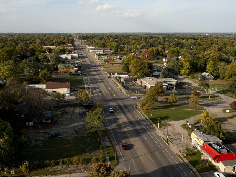
For example, a proposed section of changes focuses on a length of North Saginaw Street from Russell Avenue down to Pasadena Avenue.
Under the city’s former zoning map, 110 parcels along that stretch were predominantly designated as D-2, or “Neighborhood Business District,” meaning buildings on those parcels were “principally for goods and the needs of persons residing in nearby residential areas” according to the city’s summary of the now-outdated designation.
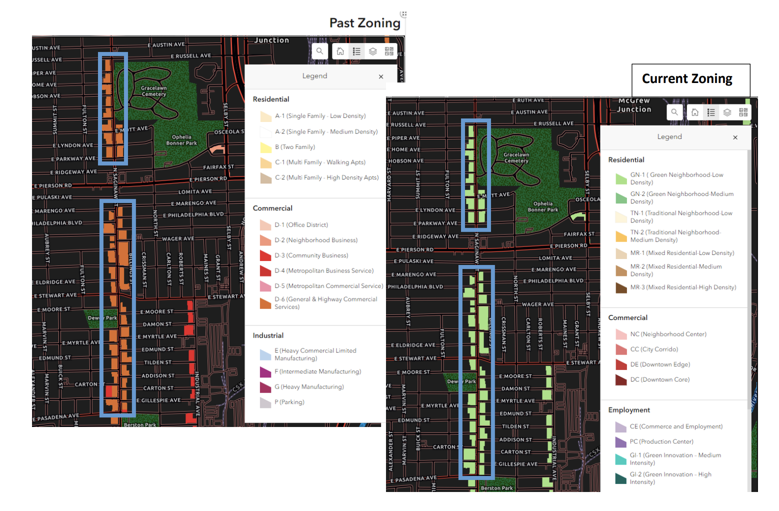
Under the city’s new zoning code, adopted in October 2022, the same parcels were rezoned to GN-1, which stands for “Green Neighborhood Low Density.”
The new designation prohibits those same parcels from being used for retail or commercial uses, instead favoring single or two-family homes, schools, libraries, places of worship, and childcare centers.
Under the proposed map amendments, the planning department suggested the parcels be rezoned to “City Corridor” or CC, which allows for many of the same uses as GN-1 but with the addition of a variety of commercial and retail purposes.
In the department’s justification of the CC zoning, staff pointed to both what’s already on the affected parcels and what surrounds them.
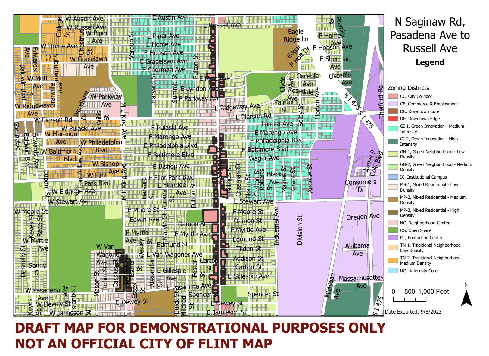
The parcels on that section of North Saginaw Street, planning staff wrote, are “low intensity commercial in nature, with almost no residential” properties. Further, “60-70%” of those properties are currently vacant.
Therefore, staff continued, “returning N Saginaw, Pasadena to Russell, to commercial zoning will allow for the re-use of a large number of vacant, commercial, parcels, while building this area as a commercial corridor which can support the abutting residential to the East and West.”
In reviewing the proposed changes on Sept. 12, Commissioner Carol-Anne Blower noted that some parcels proposed for zoning changes already had developments in the works. Blower expressed concern over what the new designations, should they pass, would mean for those projects.
Doerr told Flint Beat that if the map changes are not approved, property owners will be grandfathered in for “current commercial usage and signage” options for their properties under the existing zoning code.
“But in order to have any new signage, use, or site plan adjustments, a rezoning would need to occur first,” she added. “The proposed changes would prevent these burdens to property owners.”
After commissioners reviewed the planning department’s 82 pages of proposed changes, they suggested edits and voted to approve the zoning map amendments.
Doerr said the amendments will go before Flint City Council for a public hearing and final approval.
Support local news!
Flint Beat is here to empower, impact and inform our community. Show your support today!
Choose a monthly amount
Basic
Standard
Pro
Custom Amount
Thank you for your support!
Author